Associated
Protective Measures (APMs)
1 The newly established
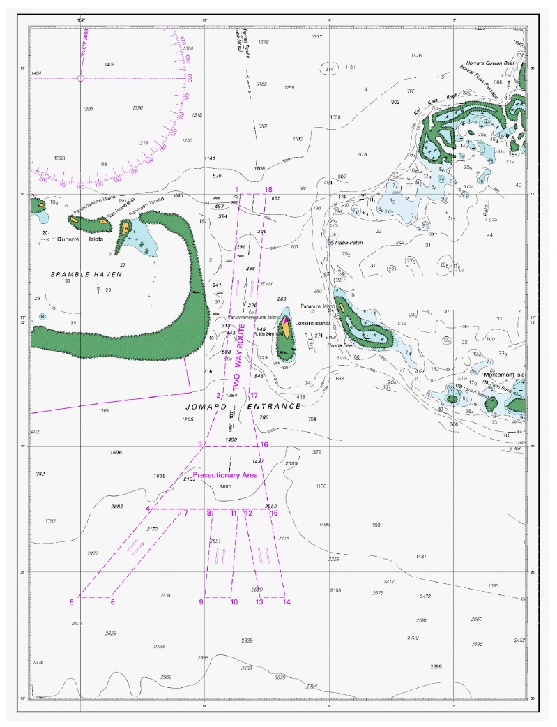
routeing systems (four two-way routes and a precautionary area) at Jomard Entrance
are the APMs, as follows:
-
.1 a one nautical mile wide Two-way route to the north of Jomard
Entrance, which extends approximately 20 nautical miles from the northern
boundary of the precautionary area, see Chartlets, below;
-
.2 three 1 nautical mile wide Two-way routes to the south of
Jomard Entrance, each aligned with the general traffic pattern to/from ports
on the east coast of Australia. The routes extend approximately 3.5 nautical
miles from the southern boundary of the precautionary area, see Chartlets,
below; and
-
.3 a quadrilateral-shaped precautionary area that lies between
the northern and southern two-way routes described above, see Chartlets,
below.
2 The two-way routes and precautionary area can be used by all
ships navigating in the area.
(Note: These routeing systems were
approved at the first session of the Sub-Committee on Navigation, Communications and
Search and Rescue (NCSR 1/3/8), subsequently adopted by MSC 94 and entered into
force on 1 June 2015.)

Chartlet 1 – Map showing the
PSSA and newly established IMO routeing systems

Chartlet 2 – The four Two-way routes and precautionary area at
Jomard entrance, approved by MSC 94